This post is also available in:  Deutsch (German)
Especially with the German and English speaking community of Windhoek, the Avis Dam is a popular destination to go on a walk with the dogs or to do some birding. With this article, I want to show you that the reservoir and the area around the dam is a worthwhile destination and I want to give you some tips for hiking routes.
General information about the Avis Dam
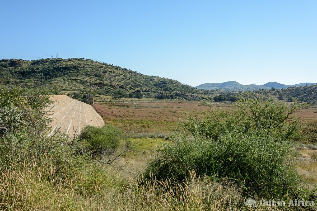
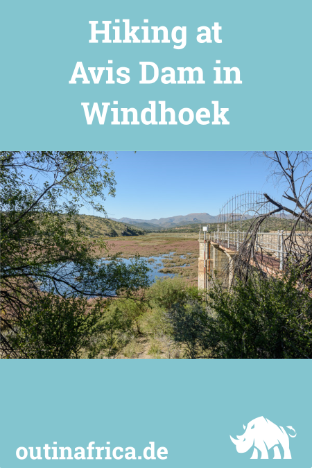
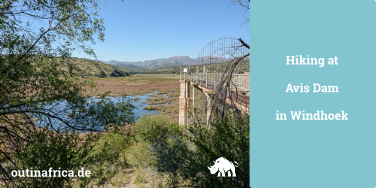
The Avis Dam is located at the eastern entry to the city of Windhoek in the suburb Avis. A dam wall dams the inflow of water of two rivers. However, the inflow is very low in the rainy season and therefore it is rare that the reservoir has enough water. Mostly there is only a small puddle, and sometimes it is completely dry.
According to Wikipedia, the dam was completed in 1933 and has a capacity of 2.4 million cubic meters. Since the reservoir makes no significant contribution to the water supply for Windhoek, the area is now valued primarily as a recreational area.
What can you experience at Avis Dam?
Many citizens of Windhoek like to go to the Avis Dam. For this there are two reasons:
- You can take your dogs for a walk. The dogs are free to roam.
- The area is a hotspot if you want to do birding.
Unfortunately, these two motivations are not always compatible with each other: free running dogs and their owners chase away the birds. Nevertheless – if you come to a time of day when there are few walkers, and especially when there is so much water in the dam that hardly anyone walks around the reservoir, you can make great bird observations. For bird lovers: forget the weekend, especially in the afternoon. Come on a weekday, preferably early in the morning and go to the eastern side of the lake.
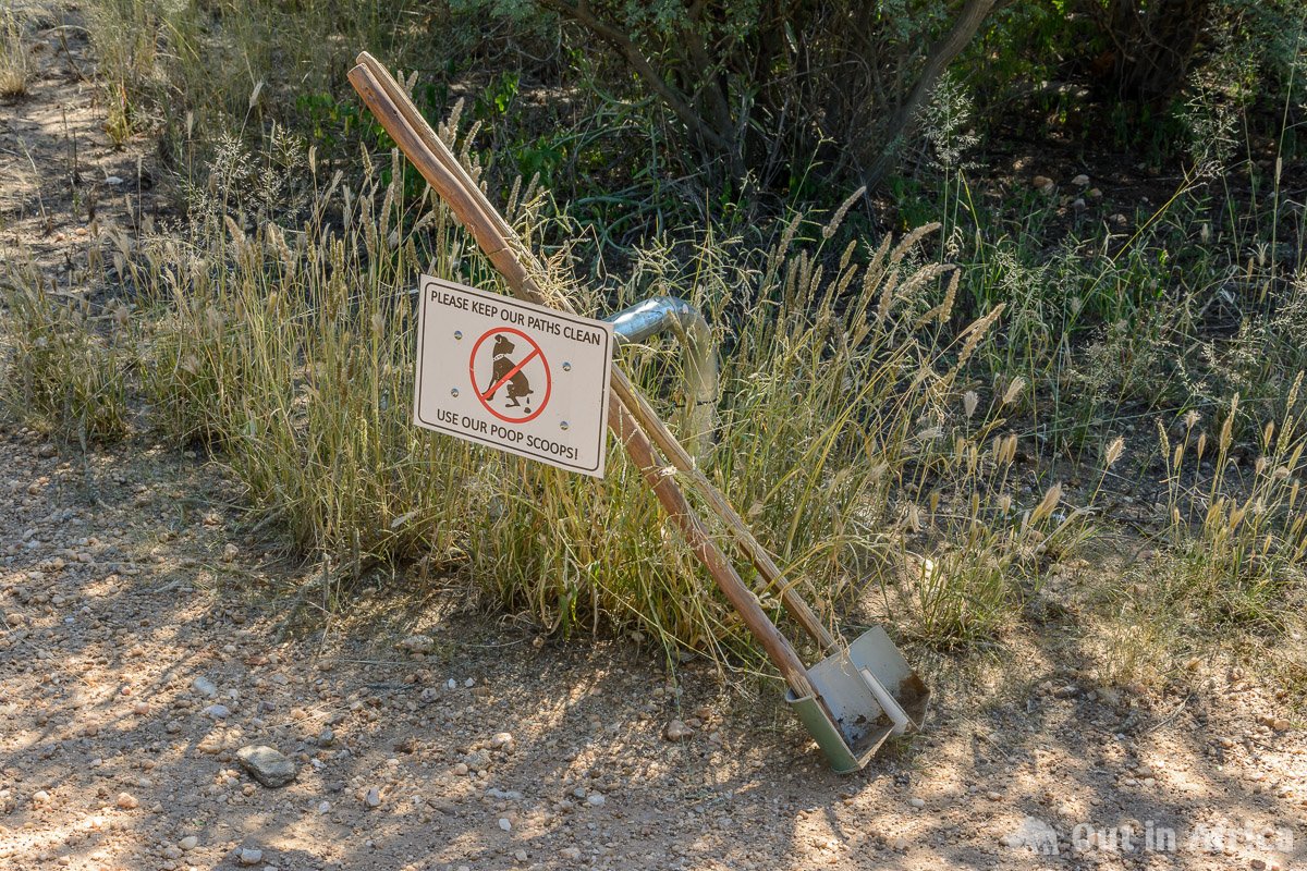
Today the area is managed by a non-profit organisation “Friends of Avis Dam”, a subgroup of Greenspace. Not only is the site maintained and kept clean, but security personnel is also provided.
Since my childhood I have visited the Avis Dam regularly and, in addition to the usual suspects such as Egyptian geese and lapwings, I have also seen unusual birds such as storks and pelicans. But it is not only because of the birds that I like to go to the dam: often mammals like kudu, baboons and warthogs come to the water. And besides the usual lizards, I’ve met a monitor. Also, the area is beautifully situated: always with a view of the Auas mountains and its highest peak, the Moltkeblick (2479m).
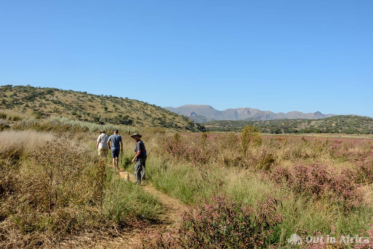
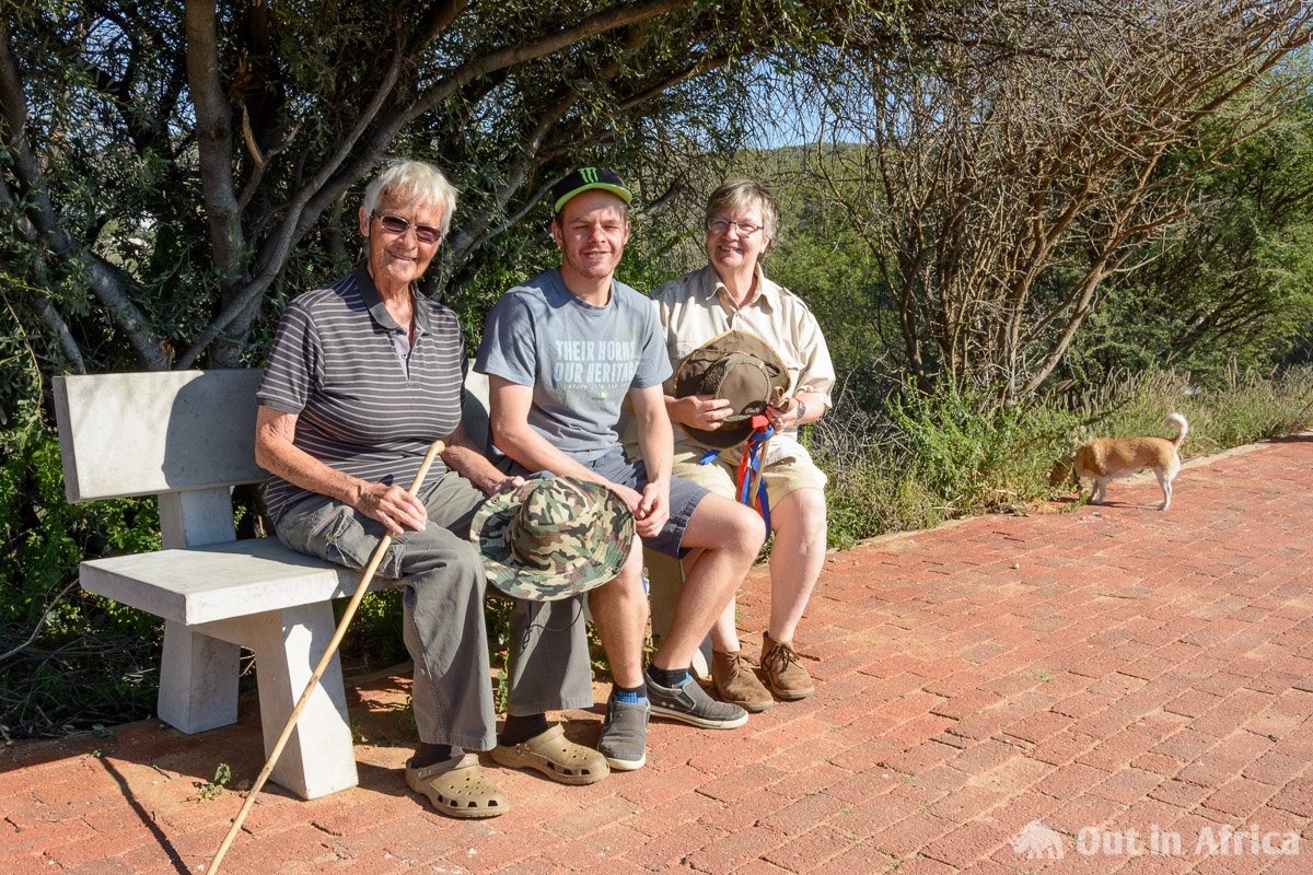
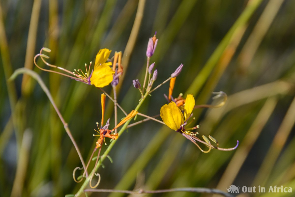
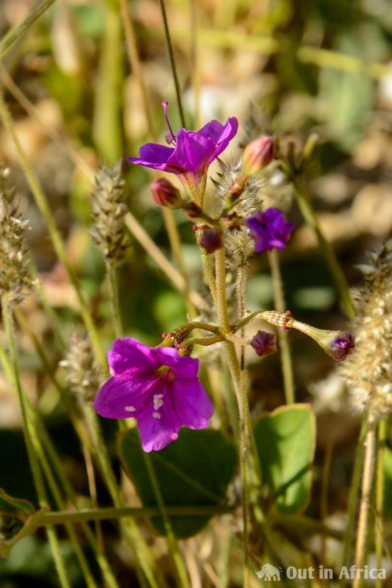
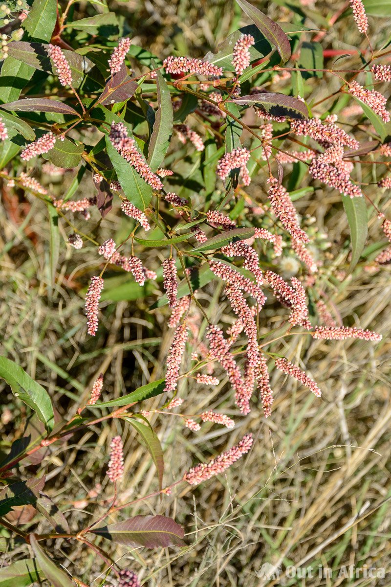
In May 2018 we were at the dam on a Saturday afternoon with the dogs. So I left the binoculars and field guide at home. But, as it was just after the rainy season, I was happy about the many flowers that were all along the way. Although other joggers and walkers were around, the area was by no means overcrowded, and therefore I thought I could write about the possible routes around the dam. Thanks to Google Earth I could see a satellite image of the area:
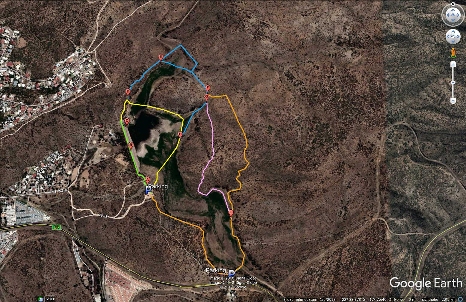
and create a map on Google Maps:
In the following, I will explain these in more detail.
Parking spaces at Avis Dam
The main car park is near the dam (at point A). Alternatively, there is a parking lot at the B6, which is hardly used and if, then only if there is a lot of water in the reservoir. I recommend the main car park. The way to reach the parking area is signposted at the crossing B6 and Paul Kruger Street. Alternatively, you can turn off Sam Nujoma-Drive onto Avis Road.
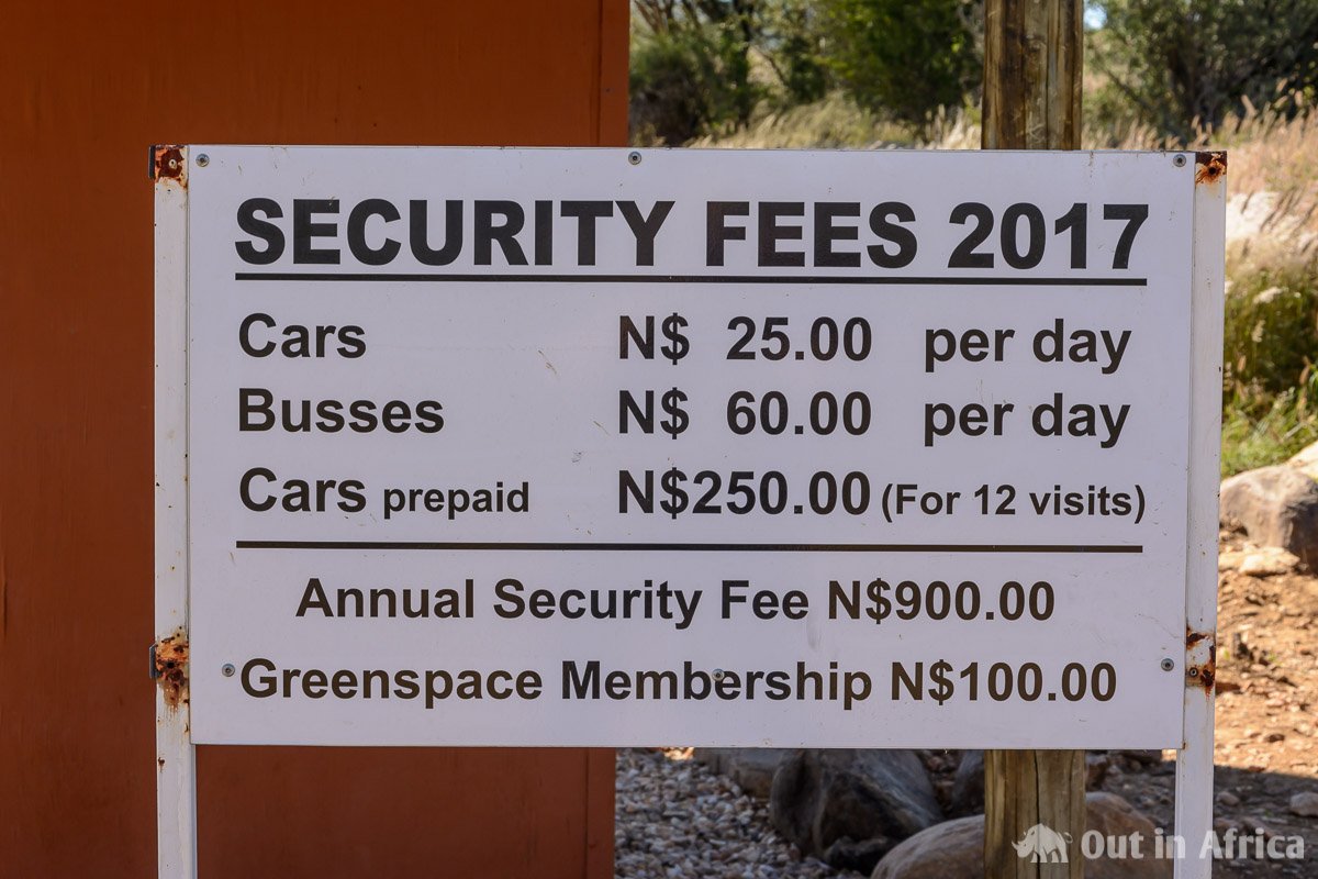
You have to pay a fee for the parking lot. The money is used by the Friends of Avis Dam to maintain the infrastructure, keep the site clean and pay for several security officers. We find the costs reasonable and occasionally additionally bring the security personnel on duty a fruit or a cool drink. Until now, we have always found the security staff very friendly and helpful.
Security Advice
During our visit in May 2018 we found the following safety information at the parking lot:
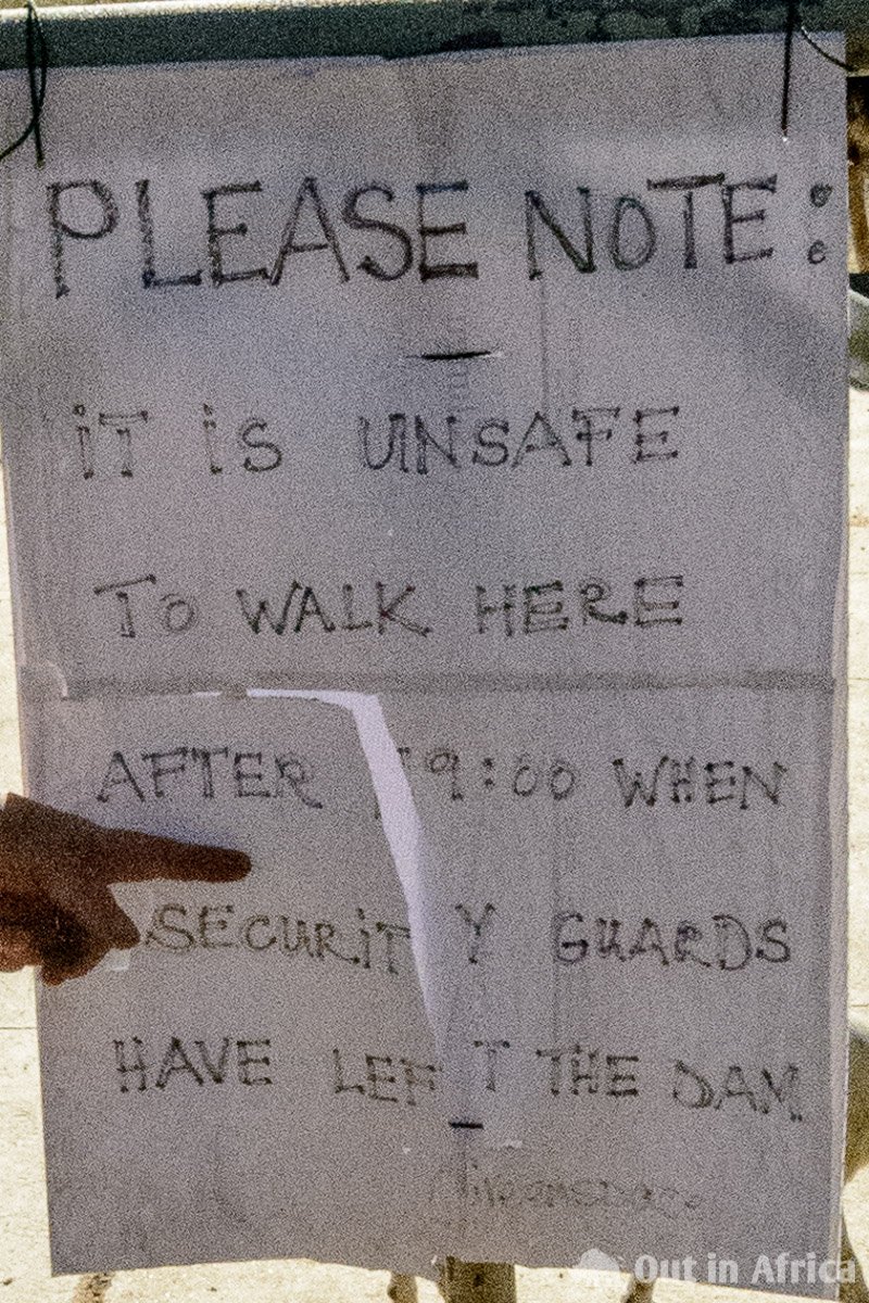
Unfortunately, it has happened in the past that hikers were robbed at Avis Dam. To avoid this, security personnel is present, but they can’t always be everywhere, and therefore you should pay attention to the following:
- Lock the car.
- It is best not to leave valuables (money, passports, tickets) in the car.
- It is best not to carry valuables with you. The birdwatcher with binoculars or the photographer with a camera must decide for himself. In Namibia, people are getting robbed because of their smartphones.
- It’s best not to walk around the grounds alone. It helps to take a big dog with you.
- It’s best not to go to the back corners of the area.
- Be careful, especially with people who do not fall into the usual scheme of the Avis-Damm walkers.
- When you get robbed, don’t fight, but give the attacker what he wants. It’s not worth risking your life or health over a smartphone.
After all these frightening tips, I would also like to say that robbery does not happen very often. Avis is one of the safest residential areas in Windhoek. I usually take my smartphone with me because it has a birding app on it. And most of the time I have either my camera or my binoculars, often both with me. Moreover, I like to go to the back corners of the area, because you see more animals there. And yes, I go for a walk alone and without a dog.
Hiking routes at the Avis Dam
To the routes. They’re not official routes, but paths I’ve already explored. I colour-coded them on the map.
Green Route
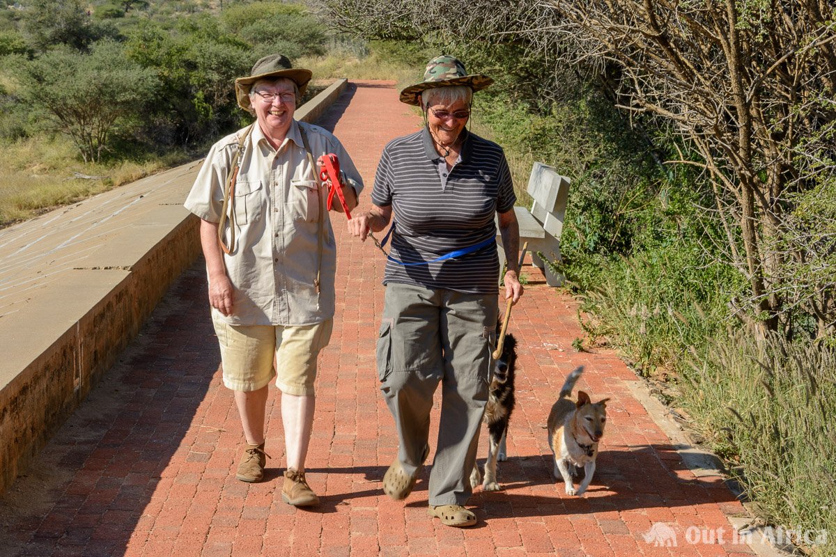
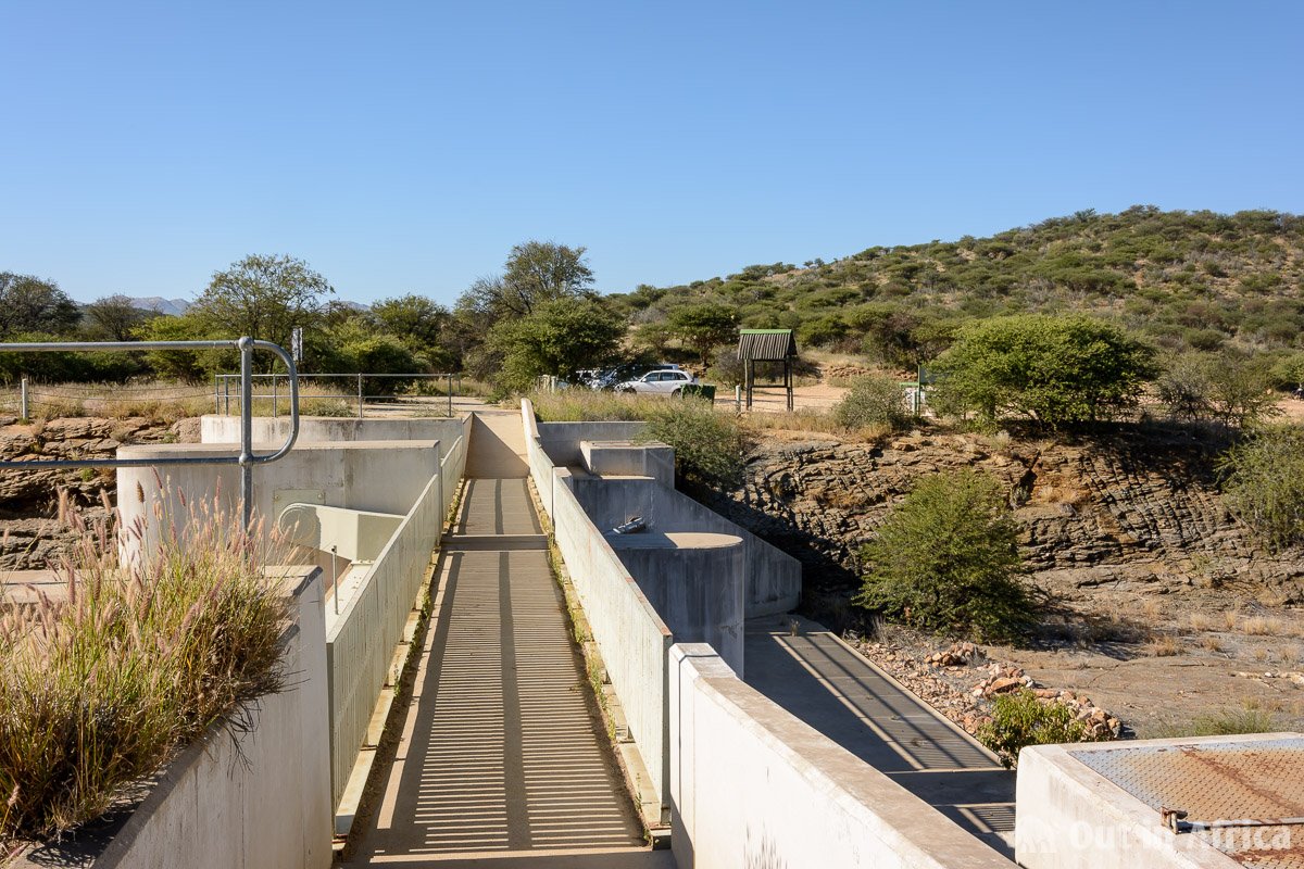
The green route goes from the car park, over the spillover (point A) to the end of the dam (point B) to the gauge (point C) and is 600 m long. The path is paved, and most people walk here. Many go only to the end of the dam wall and then back again.
Yellow Route
The yellow route can be taken if there is little or no water in the reservoir. It goes from the end of the dam to point D (the first possibility to go down into the river bed) and then around the puddle that is mostly in the reservoir, to the foot of the small hill and then always along the shore of the puddle back to the parking lot. This route is 1,200 m long. The path is an unpaved footpath, but it is well-trodden and therefore easy to walk.
In May 2018 we first took the green route to the end of the dam and then the yellow route, which is almost 1.8 km in total. Since we dawdled a lot, looked around, let the dogs swim and took pictures, it took us about an hour.
Blue Route
The blue route is 1,479 m long, unpaved, but also suitable to walk. At point E you can decide if you want to take a shortcut. It is my favourite route because you can see many more birds and other animals there. When you leave the riverbed, it’s a little uphill, but the climb is very comfortable.
Depending on the amount of water in the dam, you can continue along the blue route until it meets the yellow route at point H.
Orange and Pink Route
If there is a lot of water in the reservoir, you have to decide at point F or point G which of the longer routes to take. Both run through the hills on the eastern side of the reservoir. Both are sometimes steep and rocky in the descent. Sturdy shoes are essential here.
The orange route is 2,580 m long and starts at point F. With it, you reach the riverbed on point I and then it is effortless to return to the main car park via the second car park near the B6.
The pink route is 1,100 m long and starts at point G. Walk along it to the riverbed and then up to point I, where you meet the orange route.
Additional information
As I have already said, the routes I have proposed are not official routes; they are just suggestions. They’re not marked. You can go wherever you want.
Depending on how hot it is and which route you choose, it makes sense to take a water bottle with you.
I hope you enjoy the Avis Dam. If you have route suggestions or had nice (or not so nice) experiences, please let us know in the comments.
[amazon box=”1775840999,1920602011″/]

Interesting information thank-you.
This is a lovely place to walk. Plenty birds to see and I also saw a warthog. Its a shame there is no directional marking for the paths as it is not clear at some stages which one to take. Your guide is very useful though. Thank you!